
Starting trip meter 0.0 at the Ripley County Historical Society Archives on Washington Street in Versailles across from the Ripley County Courthouse. Go south on Washington to Tyson Street, turn right, go one block, turn left, go to U.S.50, turn right (west). Go to trip meter 7.0 to Tour Stop 1.
Tour Stop 1 (39° 4′ 29″ N 85° 22′ 30″ W)— Dr. Cady and the Holton Station: Dr. Andrew P. Cady, Henry King, Henry Hughes, and James Creath, along with Arvin Quier managed a very busy Underground Railroad station in Holton.
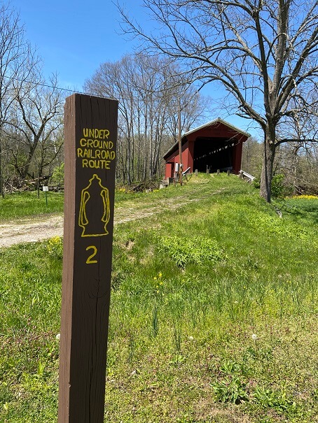
>>When U.S.50 makes a bend to the left, stay straight and go through Holton on the old Main Street. Go to trip meter 8.15 and turn right onto County Road 850W. Go to trip meter 9.4 to the Otter Creek Covered Bridge which is Tour Stop 2.
Tour Stop 2 (39° 5′ 6″ N 85° 24′ 34″ W)–Otter Creek Covered Bridge: The old logging road led from Lock Springs at the sawmills to the Holton railhead. Huge oxen hauled Poplar timber down the six miles where they were loaded on the Ohio & Mississippi Railroad. In Cincinnati, these large Poplars become rafters in the city’s schools and public buildings. This was also an Underground Railroad route.
>>Continue north 15.1 miles on County Road 850W to Tour Stop 3 which is Lock Springs. Watch when County Road 850W jogs right then left at 500 N. (trip meter 14.0 and 14.3).
Tour Stop 3 (39°09’31.1″N 85°24’47.1″W)–Lock Springs: Once a busy sawmill center that was named for a lock Jerry Hull put on his springhouse that stored tools, Lock Springs is no longer a town. Only one original brick building stands where once three mills, a grocery, a blacksmith, and the first telephone line in this part of the county formed the town of Lock Springs. It was also the residence of the Hulls, the Hughes, Printys and others in the UGRR in the Flat Rock area.
>>Take County Road 850W north and go to trip meter 15.35 to the intersection of County Road 600N to Tour Stop 4.
Tour Stop 4 (39° 9′ 45″ N 85° 24′ 47″ W)–Israel Cooper: In the midst of the strong pro-Union, anti-slavery communities at Flat Rock and Lock Springs, Israel Cooper along with his relatives and friends, detested abolitionists and tried to catch fugitive slaves to return them to their masters.
>>Turn left, then right with County Road 850W. Go north to Flat Rock Road to trip meter 16.5 and turn left. Continue to trip meter 17.15 to the Daniel Adams homestead located on the left to Tour Stop 5.
Tour Stop 5 (39° 10′ 13″ N 85° 25′ 52″ W)–Daniel Adams Homestead: Daniel Adams was a carpenter for several of the homes and the original Freewill Baptist log church.
>>Continue west to trip meter 17.6 on Flat Rock Road to Tour Stops 6 and 7 and then Tour Stop 8 at trip meter 17.9.
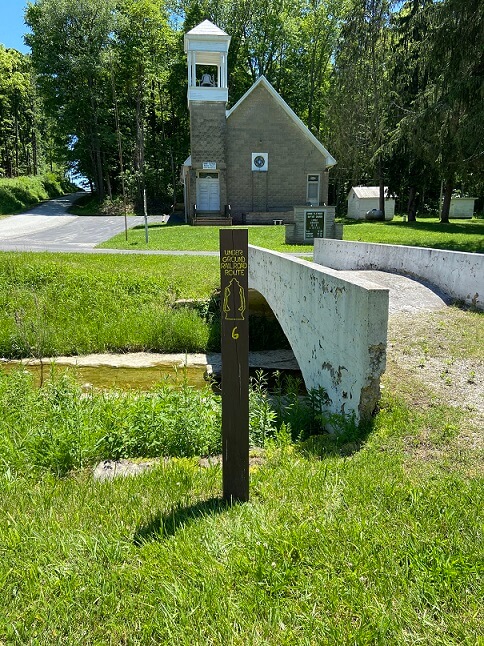
Tour Stop 6 (39° 9′ 58″ N 85° 26′ 12″ W)–Flat Rock Freewill Baptist Church: This church was established in 1843 as an anti-slavery congregation. Runaway slaves attended church and Sunday School services here. The church sits on Judd family lands.
Tour Stop 7 (39° 9′ 59″ N 85° 26′ 12″ W)–Flat Rock Cemetery: Most of the original abolitionists are buried on this hillside.
>>Continue .3 miles on west on Flat Rock Road to Tour Stop 8.
Tour Stop 8 (39° 9′ 53″ N 85° 26′ 27″ W)–Harvey Marshall Homestead: Home of the first Deacon of the Flat Rock Freewill Baptist Church and Stationmaster of the Underground Railroad in Flat Rock.
>>Turn around and go to trip meter 19.2 to County Road 850/900W. Stay left on County Road 900W to trip meter 19.6 to the junction of County Road 725N to Flat Rock which is Tour Stop 9.
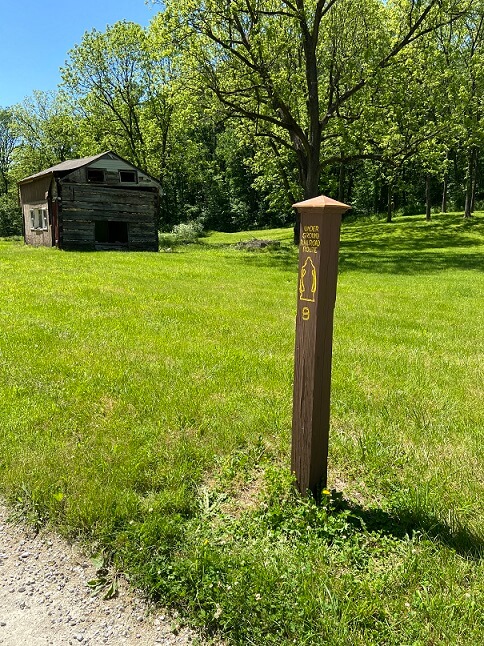
Tour Stop 9 (39° 10′ 46.5″ N 85° 25′ 17.2″ W)–Flat Rock Community: Many descendents of the original Underground Railroad conductors and safe houses still live in this area.
>>Continue north on County Road 900W for to trip meter 20.3 to the junction of Brownstown Road. Tour Stop 10 is on your right at the corner of Brownstown Road and 900W.
Tour Stop 10 (39°11’25.9″N 85°25’16.4″W)–Brownstown Road: In the 1830’s and 1840’s, Brownstown Road, leading from Napoleon, was the major stagecoach route from Cincinnati to Indianapolis. The major route from Madison to Terre Haute and Detroit was Michigan Road. Michigan Road was completed through Napoleon in 1852.
>>Continue on Brownstown Road to Millhousen Rd. to U.S. 421. Turn right on U.S. 421 and return to Versailles.