This gorgeous park is easily accessible from the road.
It doesn’t seem possible that it’s already November. The weather is turning cooler and it’s been pretty rainy in Ripley County. One overcast day I took the opportunity to drive part of the “Bike Southeast Indiana” bike trail. I am working with Dearborn, Decatur, and Jennings Counties Tourism Bureaus to update our joint bike brochure/map for next year and thought it would be a good idea to see what the trail had to offer. Exploring the trail gives me a better understanding of what it’s like so I am better equipped to explain it to someone else.
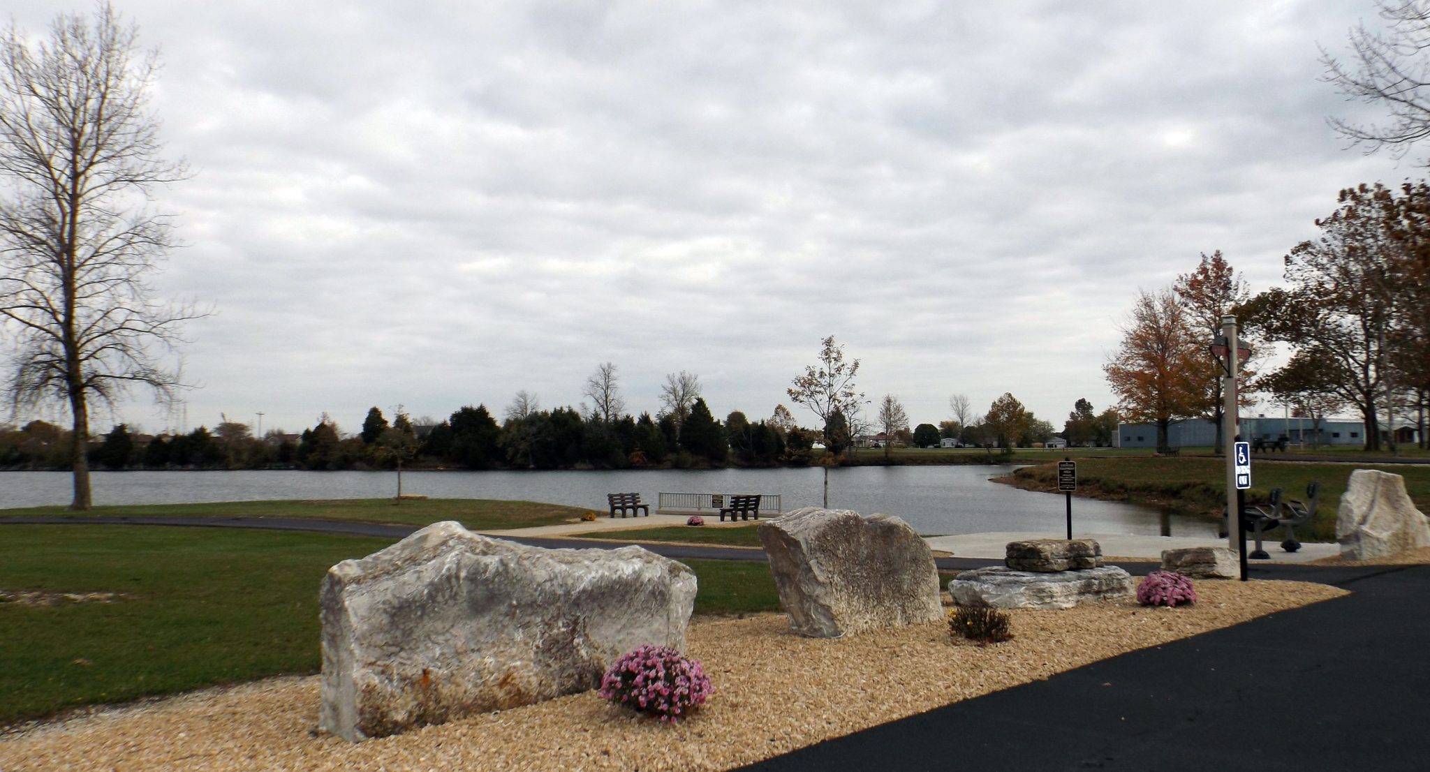
For this leg of the tour, I began in Batesville and drove south on Highway 129 to Delaware; went east on Highway 350; traveled south on Highway 421 in Osgood to County Road (CR) 300 N. I traveled west for less than a mile when I came upon a gorgeous area with lakes and paved walking trails on either side of the road.
Th e lakes were formed from rock quarry ponds. Park benches, outdoor exercise equipment, picnic tables, and a fishing area are all part of Osgood Trails (1820 W County Road 300 N, Osgood, Indiana). The trails are open dawn to dusk each day and even allow grilling in designated areas. What a great place to relax and take in nature’s beauty. The trail is open to walkers, bicyclists, and pets on a leash and is handicap accessible.

Bilby tower
There are four loops to the 1.27 mile trail: Crusher Lane, Dean’s Loop, Bilby Loop, and Eagle View. Crusher Lane was named for the old rock crusher that made the stone that the quarry produced. Bilby Loop will take you past Bilby Tower. Surveyors Historical Society erected the historic Bilby Tower at the park. Osgood is the hometown of Jasper Bilby, who invented the innovative survey tower in 1927.
I was just getting back into my car when I caught a glimpse of an eagle – thus the trail moniker Eagle View. It was a breathtaking sight. I watched as the eagle swooped down to the water and flew away. Unfortunately, I had put my camera away. I was able to locate a photo posted on the Osgood Trails Facebook page.
 So back in the car, I continued to Tanglewood Road where I turned south; then east on W Hopewell Road for a short jog south on CR 175 (which crossed US Highway 50); from CR 175, I traveled east on W Tanglewood Road, which turns into S Tanglewood Road and back to my office in Versailles.
I’ll check out more of the bike trail another day. Along the way, I’ll share more interesting places and faces I find.
More later…
Terri